Interactive map
The Atlas of Middle-earth
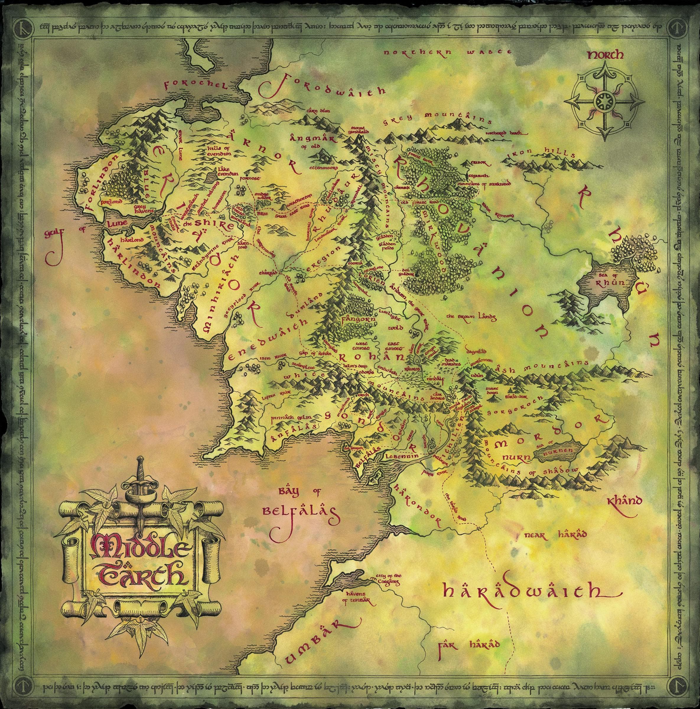
Pan and zoom across the Westlands. Marker positions are approximate and the map reflects the geography of the late Third Age.
A map of the Third Age
This atlas shows the Westlands as they stood in the late Third Age, so the lands of earlier Ages cannot sit on it: Beleriand was drowned at the end of the First Age and Númenor sank beneath the Sea in the Second. Those places are documented as text entries in the archive — browse all locations.
Drag to pan · scroll or pinch to zoom. Marker size carries no meaning.
29 places shown on the map.
Reading the map
How to read what the atlas shows — and what it deliberately leaves off.
Approximate positions
Each marker sits at percentage coordinates on the atlas image, placed for orientation rather than cartographic precision. Realms and regions cover more ground than a single point can show, and a few places deliberately share a broad location (Minas Tirith stands within Gondor). Marker size carries no meaning.
One Age, one geography
The image reflects the Westlands of the late Third Age. Beleriand was drowned at the end of the First Age and Númenor sank beneath the Sea in the Second, so places of those Ages are documented as text entries rather than dropped onto this map.
Continuity labels
Every place carries an Age, and the archive records where each entry comes from — Tolkien’s published texts or supplementary writings. The atlas deliberately does not blur the geographies of different Ages into a single image.